

Elbrus expeditions. Trekking and ski-touring in the Mount Elbrus area. Caucasus Mountains, Russia. Mt Elbrus climb.
gb@geographicbureau.com phone: +7 812 230-45-76 Postal address: 197110, P.O. Box 162, St Petersburg, Russia


Main page
>ABOUT THE CAUCASUS
ABOUT THE CAUCASUS
For the purposes of this work the Central Caucasus is deemed to extend WNW-ESE from the Chiper Karachai pass (3296m) to the Krestovy pass (2388m). The straight-line distance between these points is about 200 km.
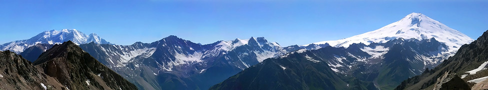
Geographers declare that the basic relief of the central range consists of 2 roughly parallel lateral ridges. The Glavniy ( Main or Great Caucasus) is continuous, while along its north side the Bokovoi (lateral) is disjointed and broken into numerous isolated massifs separated by deep valleys. (More particular offshoots of the Central Caucasus are identified in a separate map here).
Bokovoi is a name or term rarely seen on Western or Russian maps. Except for the Bezingi Wall section of the Glavniy, as such it includes nearly all the highest summits of this tremendous mountain system: Elbrus, Adyrsu, Dykhtau, Koshtantau, Sugan, Teplitau, Gimarai and Kazbek. Thus the Great Caucasus ridge is deflected S at the Adai Khokh massif, across the Mamison pass to Kozi Khokh, to continue E over Khalatsa, Zikara, Zilga Khokh and Kalasan to the Krestovy pass. As a watershed, this analysis is correct, but visitors to the range will always regard the Bokovoi sections as an integral part of the Great Caucasian chain. Moreover, the matter has been further complicated in the 20th century by political machinations in awarding and subtracting territory between Russia and Georgia. These events were mostly instigated by Stalin in various population purges when entire communities were transported to Siberia in response to quelling uprisings. For instance, when the Karachai was subdued the revised frontier passed N of Elbrus, so putting that mountain and the upper Baksan within Georgia; but the most frequent change has occurred in the neighbourhood of Kazbek, and the frontier now properly runs along the Gimarai (Bokovoi) chain, and not along the watershed of the range to the Krestovy pass.
In general, the lower elevations, outer ridges and gorges are formed and cut in limestone beds while the higher ridges and all the main chains and massifs reveal firm crystalline rocks, including shales, gneiss and granites. Thus fine glacier cwms reminiscent of the Alps are carved in the upper ridges, their walls forming sharp crests upon which shapely peaks rise.
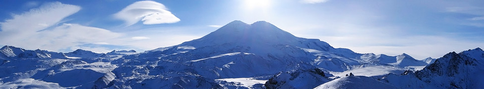
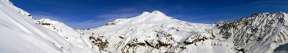
Glaciers are very numerous, and obviously longer and larger on the N side of the range. Like the Alps and other major northern hemisphere mountains, glaciers have been retreating steadily for many decades. Regression is averaging 15-25m per annum. Extensive snowfields cover the old volcanic cones of Elbrus (140sq.km) and Kazbek (80sq.km); many smaller snowfields exist. In the Caucasus the longest valley glaciers are, on the N slope, Dykhsu, Bezingi and Karagom; on the S slope, Lekhzir and Zanner. Their length at present varies from 14 to 11 km.